| |
Cloud Cover
ARCTIC COMBINED
(East = lat. >65N, long. 00-180)
(West = lat. >65N, long. 180-00)
Back to Cloud Cover main page |
| |
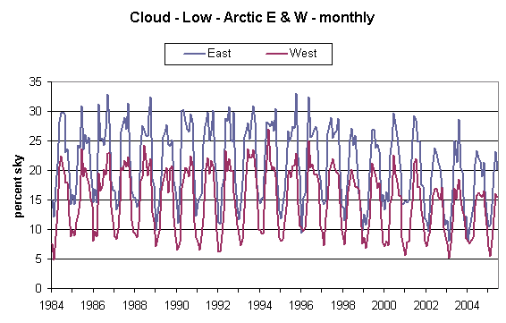
Fig 1 - Low Cloud - Monthly values |
|
Notes:
1 - Year label corresponds to January of that year
|
| |
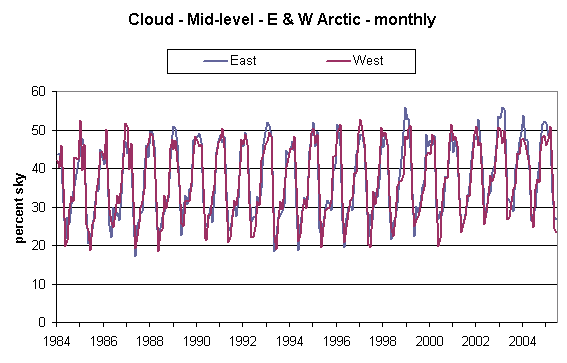
Fig 2 - Mid-level cloud - Monthly values |
|
Notes:
1 - Year label corresponds to January of that year
|
| |
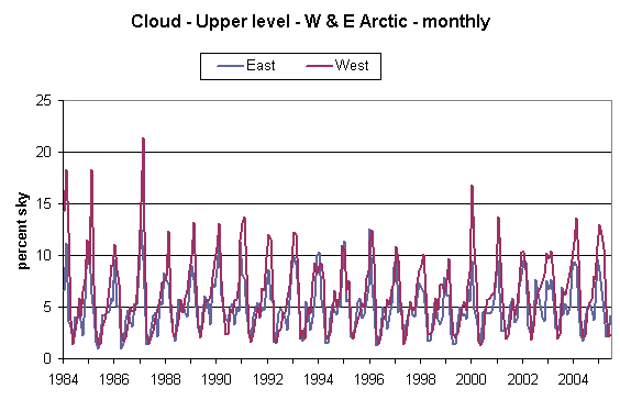
Fig 3 - Upper-level cloud - Monthly values |
|
Notes:
1 - Year label corresponds to January of that year
|
|
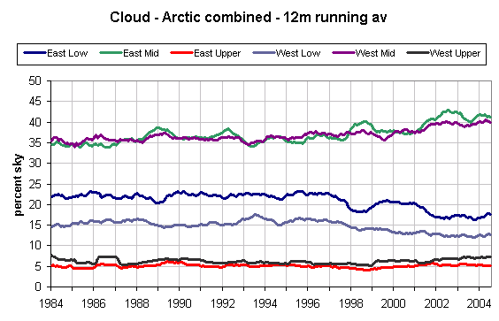
Fig 4 - Running 12-month averages. |
|
Notes:
1 - Data is average of current month and 11 previous months.
2 - Year label corresponds to December of that year (hence the annual average cloud cover).
|
|
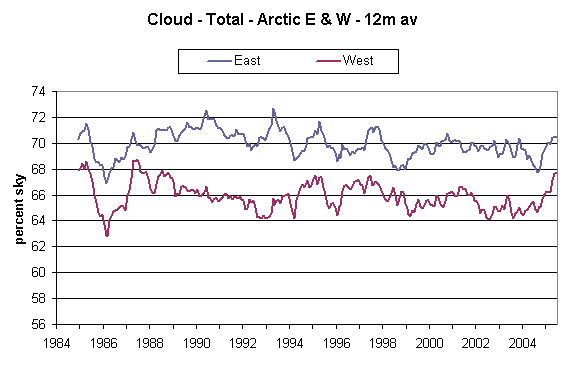
Fig 5 - Total cloud as running 12-month averages. |
|
Notes:
1 - Data is average of current month and 11 previous months.
2 - Year label corresponds to December of that year (hence the annual average cloud cover).
|