Cloud Cover |
|
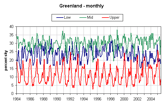
Fig 1 - Monthly values |
|
Notes: |
|
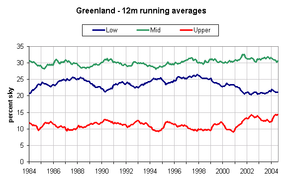
Fig 2 - Running 12-month averages. |
|
Notes: |
|
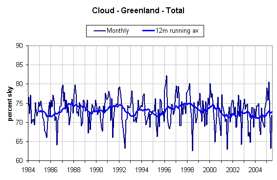
Fig 3 - Monthly and running 12-month averages. |
|
| Notes: 1 - Total is not the sum of low, mid and upper level cloud. Measurement is different and cloud may be multi-level. |
|
Fig 4 - Average January-April cloud cover |
|
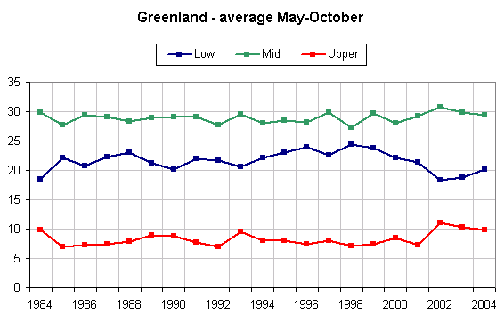
| Notes: 1 - Cloud cover averages for May to October (inclusive), shown mainly to consider the possible influence on any melting of glaciers and the melting of nearby Arctic sea ice. |